The area traversed by Sand Creek Road is a classic California landscape in remote Colusa County. You’ll pass through a mix of habitats, including a broad open valley, oak woodlands, and chaparral. After 11 miles, you’ll come to an overlook with a wonderful panorama of the Central Valley, the Sutter Buttes, the Capay Valley, the Coast Range, and, on a clear day, the Sierra Nevada.
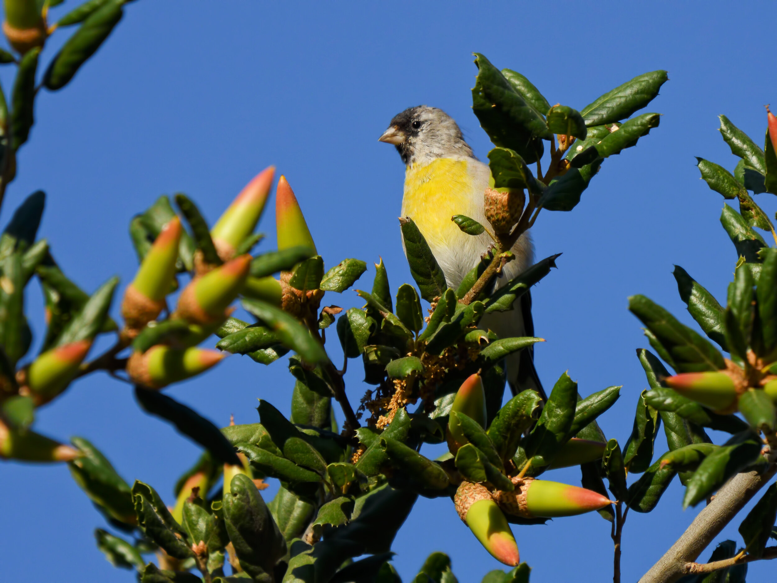
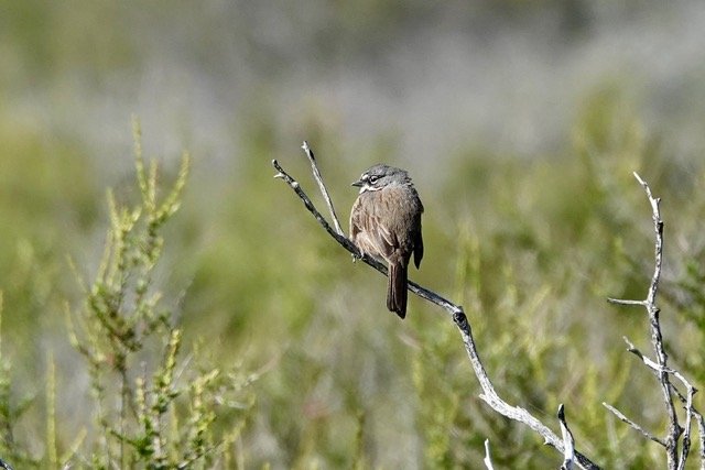
This is the best site locally for Greater Roadrunners and among the best for Lawrence’s Goldfinches. California Thrashers and Bell’s Sparrows are commonly heard and often seen in spring, and Black-chinned Sparrows are possible. Mountain Quail call in the spring. Night drives have produced Western Screech-Owls (common), Common Poorwills, bobcats, and gray foxes.
Spring is best, but fall has also been very productive. Winter visits are possible except after heavy rains, though there is the option of walking part of the route from the Yolo County side. Summer can be very hot, but has produced Greater Roadrunners and Lawrence’s Goldfinches.
Lawrence’s Goldfinch, Image by Daniel Lee Brown
Birding the site: For the first few miles on Sand Creek Road, the country is quite open. Lesser Nighthawks have been seen in the early mornings near the beginning of the road. Yellow-billed Magpies are often plentiful, as are Common Ravens and Lark Sparrows. Golden Eagles are also regularly found.
At 3.6 miles, the road turns to gravel for a short stretch. The pavement picks up again, then disappears completely. The half-mile stretch after the first break in the pavement is prime Greater Roadrunner country. In recent years they have been seen on at least half of the visits reported— often right along the road. There have been additional reports from several locations in the next six miles until the road begins climbing through dense chaparral. In areas of oak savanna and open woodlands, Lewis’s Woodpeckers have been found from fall through spring. Rock Wrens are also common near the rocky creek bed where the roadrunners are often seen.
The road crosses small creeks in a few places. These shouldn’t pose a problem except shortly after a heavy rain. There is a “Y” in the road at 6.5 miles, where the main road goes left. There is another “Y” at 10.3 miles, and the main road goes right. Both of these side roads can be explored, though they end at gates after a short distance.
In summer and fall, the remnant water in the creek beds can attract Lawrence’s Goldfinches and other species to drink and bathe (learning the Lawrence’s high “tee-too” flight call helps with detection). The best site has been at mile 9.9, where the road crosses a small creek. Many other species have been seen here, including thrashers, Bell’s Sparrows, and Purple Finches—often in the middle of the road.
Bell’s Sparrow, Image by Susan Goodrich
After passing the “Y” at mile 10.3, the road climbs through dense chaparral. This and any areas of chamise and other chaparral should be checked for California Thrashers and Bell’s Sparrows. Knowing their songs is very helpful, though they are both often seen in spring. Mountain Quail can often be heard and occasionally seen in this area.
At mile 11, where the road tops out, there is a short road on the left to a convenient parking area. From here you will have outstanding views in all directions. If your primary targets are the chaparral species, you will want to arrive here early in the morning. This area is your best bet for Black-chinned Sparrow. eBird Sightings mid-route, upper end of route
Directions: From Sacramento, take Interstate 5 (47 miles north of Highway 50) to the Arbuckle/College City exit (exit 566). Turn left on Hillgate Road and go 4.8 miles to a 90 degree bend to the right. Go north from the bend for 0.4 mile to Sand Creek Road and turn left (the sign may be missing). Pavement ends after 3.6 miles, and it becomes a good quality gravel road, suitable for a passenger car as far as the Yolo County line (11 miles) unless there have been recent heavy rains.


